United States Large Area Maps
Showing 65–83 of 83 results
-

The Americas at the Time of Columbus Printed in 1658 by Nicolas Visscher
$16.00 Add to cart -

The Americas by Abraham Ortelius
$16.00 Add to cart -

The Americas by Jodocus Hondius
$16.00 Add to cart -

The Americas The Western Hemisphere by Heirs Homanns
$16.00 Add to cart -

The Voyages of John and Sebastian Cabot by Vintage Maps
$16.00 Add to cart -

Theatre of War in North America 1755 by Vintage Maps
$16.00 Add to cart -

United States 1817 by Vintage Maps
$16.00 Add to cart -

United States by Vintage Maps
$16.00 Add to cart -

Upper Territories of the United States 1817 by Vintage Maps
$16.00 Add to cart -

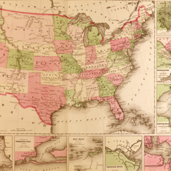
US territory in possession of the Federal Union January 1864 by Vintage Civil War Maps
$16.00 Add to cart -

USA, A Moral and Political Sketch of the United States of North America 1833 by Charles Louis Napoleon Achille Murat
$16.00 Add to cart -

USA, Attempted Colony by Raleigh by Vintage Maps
$16.00 Add to cart -

USA, British and Spanish Possessions by Vintage Maps
$16.00 Add to cart -

USA, Conflicting Grants on the territory that was to become the USA by Vintage Maps
$16.00 Add to cart -

USA, English French and Spanish Possessions by Vintage Maps
$16.00 Add to cart -

USA, French Explorers Champlain and De Monts by Vintage Maps
$16.00 Add to cart -

USA, French Explorers La Salle Marquette Joliet and Hennepin by Vintage Maps
$16.00 Add to cart -

USA, Territorial Growth of the United States by Vintage Maps
$16.00 Add to cart -

USA, The original Colonies 1783 by Vintage Maps
$16.00 Add to cart